The Cumberland Forest Project
Visualizing North America's climate defenses for The Nature Conservancy
| Client | The Nature Conservancy |
| Role | Lead Front-end Engineer, UI/UX Designer |
| Skills | Front-end Development, Geospatial Engineering, Data Visualization |
| Tech Stack | React.js, ArcGIS, Mapbox |
Overview
The Cumberland Forest Project is an initiative from The Nature Conservancy (TNC) that involves a revolutionary way to tackle species and ecology preservation in the face of climate change. Typically, preservation of species and sensitive ecosystems focus on the animal itself and what the animal needs to survive changes to its environment. As a leader in land conservation, TNC saw that focusing on one species at a time often overlooked a greater picture, emphasizing instead on the larger concept of “animal cities” or “metropolises” where large communities have come to live and rely on the resilience and diversity of the ecosystem – its ability to resist climate change.
The Project
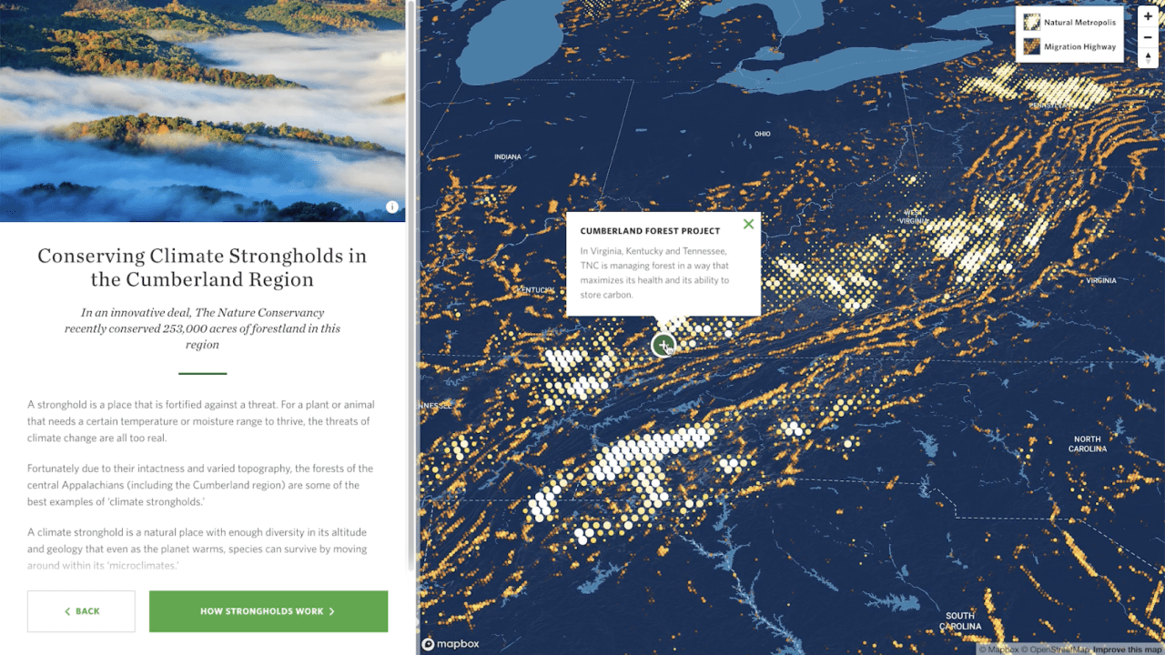
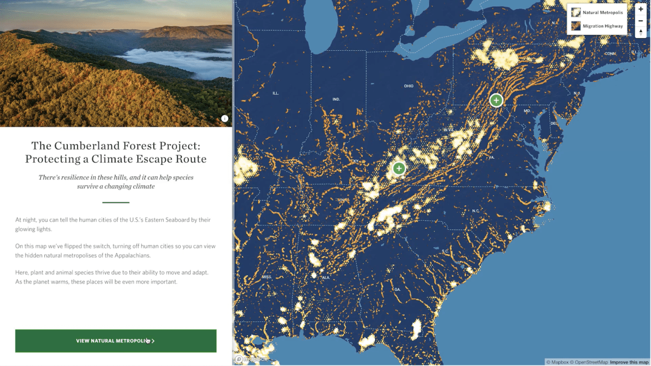
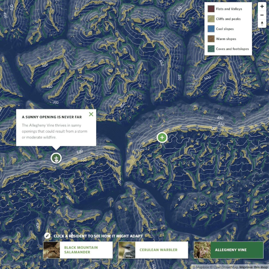
An extraordinary animal metropolis, the Cumberland Forest is “253,000 acres across Kentucky, Tennessee and Virginia, in one of the most important areas for climate resiliency in North America—the Central Appalachian Mountains.” It holds 17 different microclimates that allow species to adapt within a relatively small area. These microclimates make the Central Appalachian Mountain a “climate stronghold” – one of the most important routes for migration and the home of one of the most complex “animal cities” in North America. As human construction and changing weather patterns make survival difficult, this area continues to thrive because of its many microclimates and nutrient dense areas. By preserving this stretch of land, I can preserve the great majority of species diversity for the entire United States.
I made the interactive data visualization component designed to accompany the data report and launch of the project. I designed the interactive to visualize and explain the complex approach TNC is taking in preserving species and ecological diversity through a “land-first” approach.

UI/UX Design
My design focused on showcasing the stunning and complex data on species migration patterns, animal homes and the diverse set of microclimates that make this stretch of land one of North America’s greatest defenses in protecting species against climate change and human influence.
I worked closely with their GIS experts sorting through enormous geographic datasets to find the most effective visual way to tell the story. Since the project was a ground-breaking concept for both the TNC scientists and internal team members, I needed to invent an innovative, visual approach for explaining the migratory data that shows why this area is so important to North America.
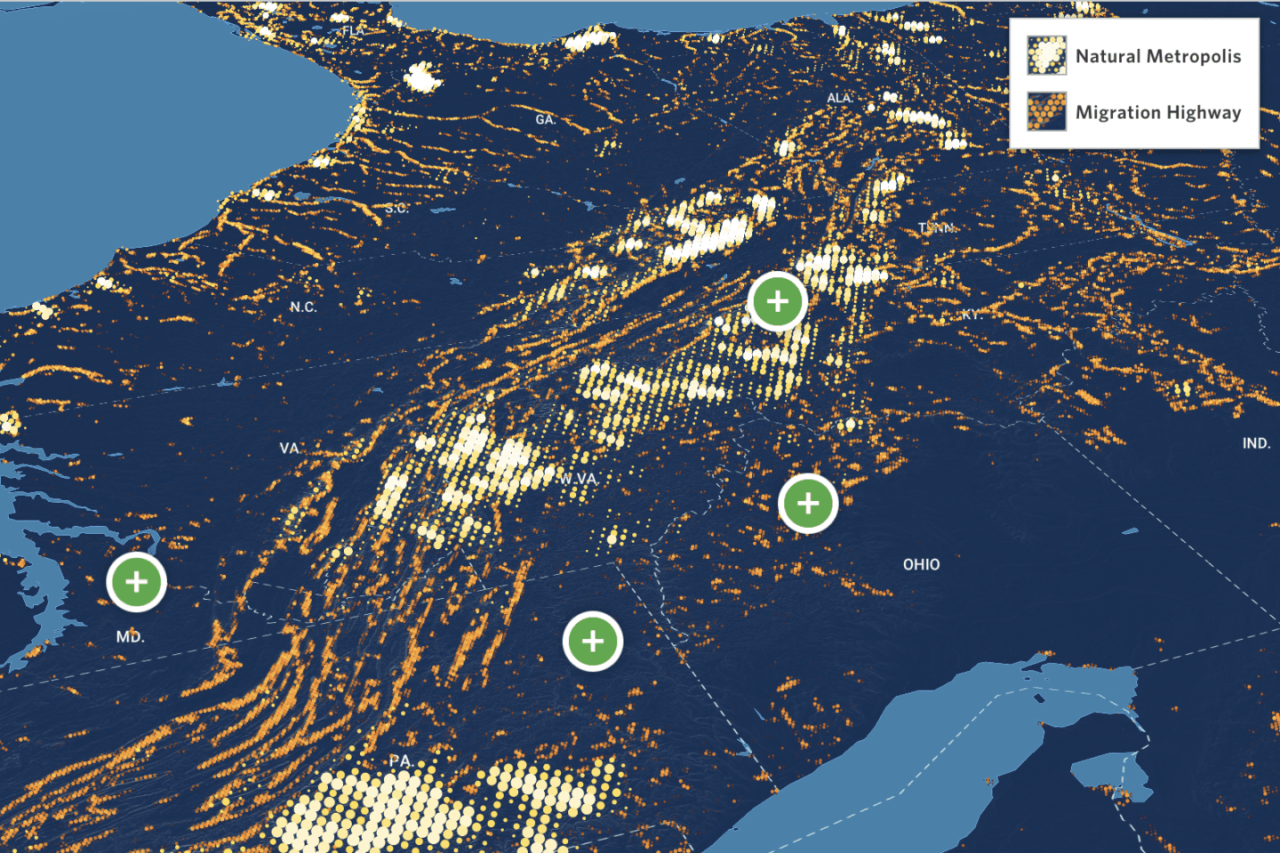
Geospatial Data
I used ESRI ArcGIS Pro to create original visual representations of extremely dense map-based migration data. The result was a series of multi-layered hexbin map visualizations of the microclimate diversity and species flow through the Cumberland region.